
Download Trail Maps
FIND YOUR NEXT ADVENTURE
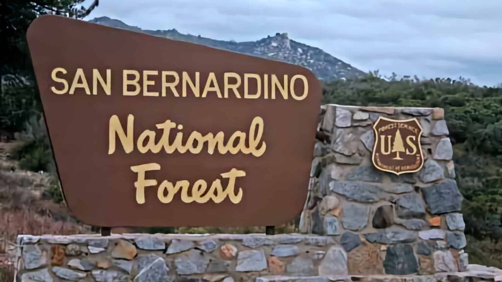
Hiking in the San Bernardino National Forest – Lake Arrowhead Mountain Communities
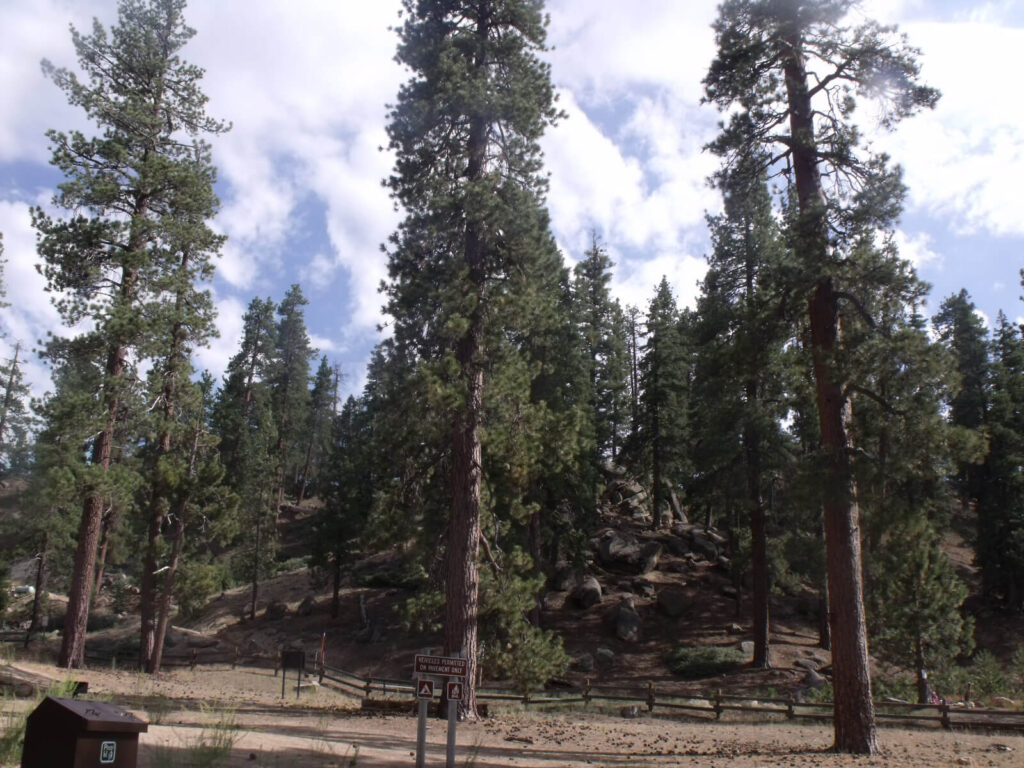
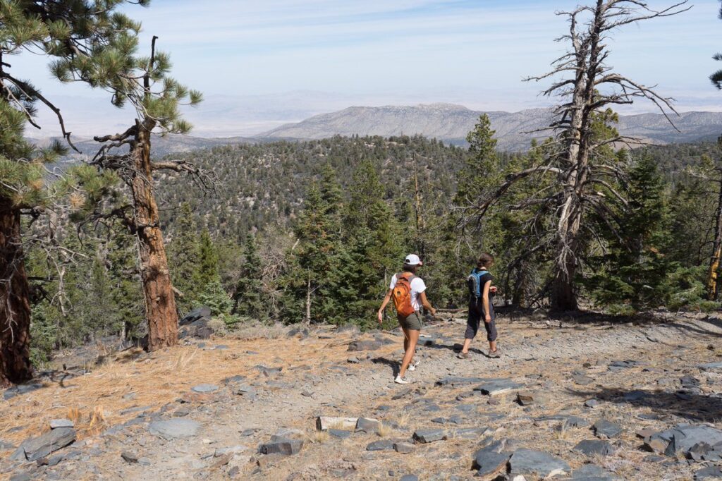
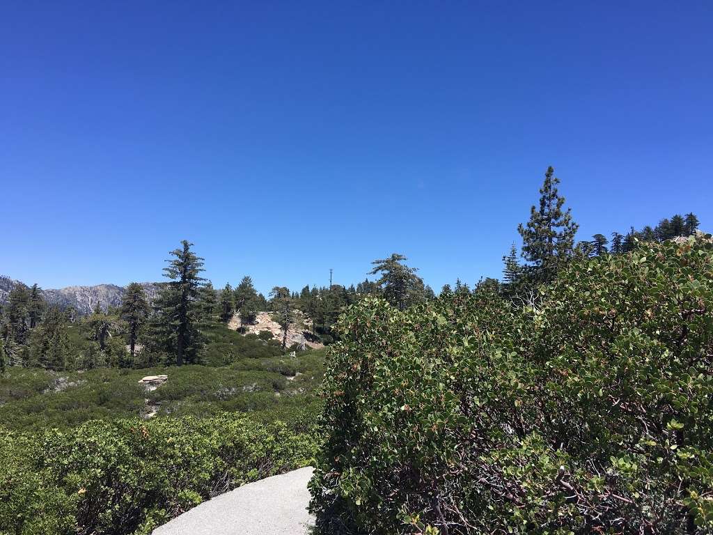
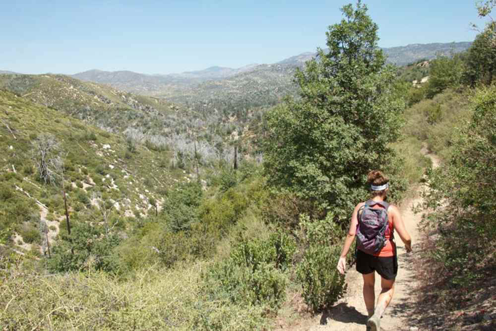
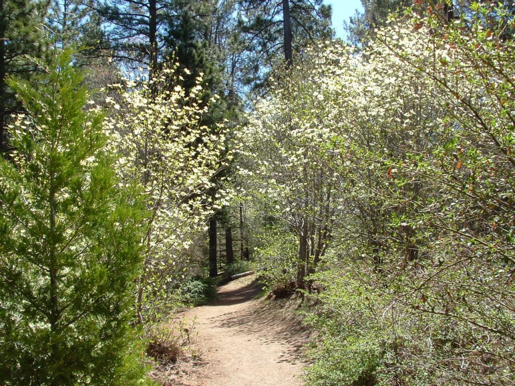
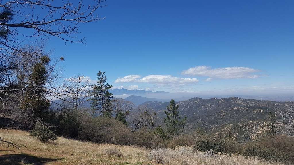
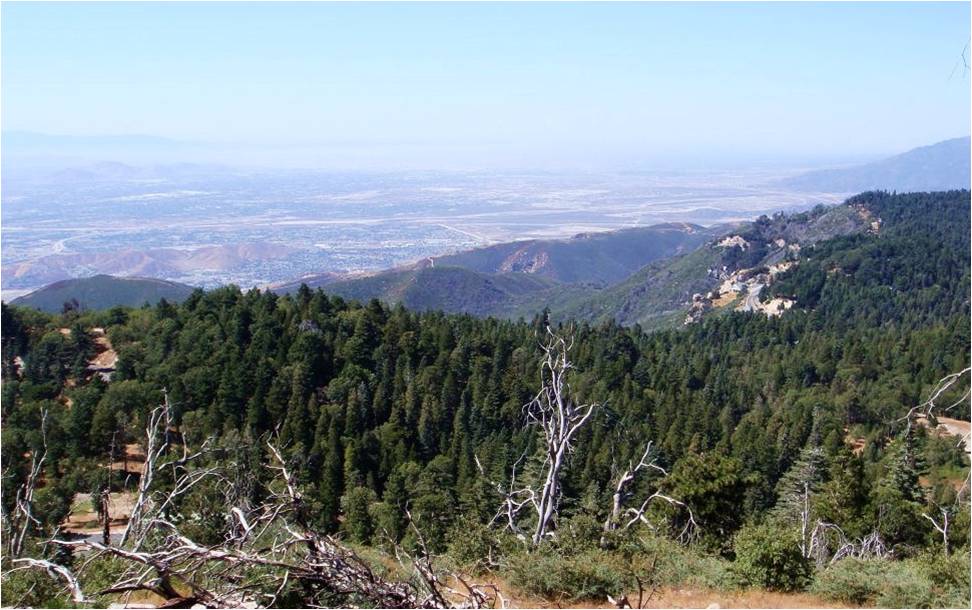
Hiking, or even just strolling, in the forest is a great way to experience the beauty and tranquility of nature. The hiking trails in the San Bernardino National Forest are among some of the best in the United States. The most notable one is the famous Pacific Crest Trail (PCT), known as “America’s Greatest Wild & Scenic Trail Experience“. It is 2,650 miles long stretching from Mexico to Canada through the states of California, Oregon, and Washington.
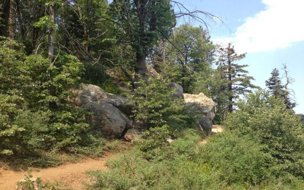
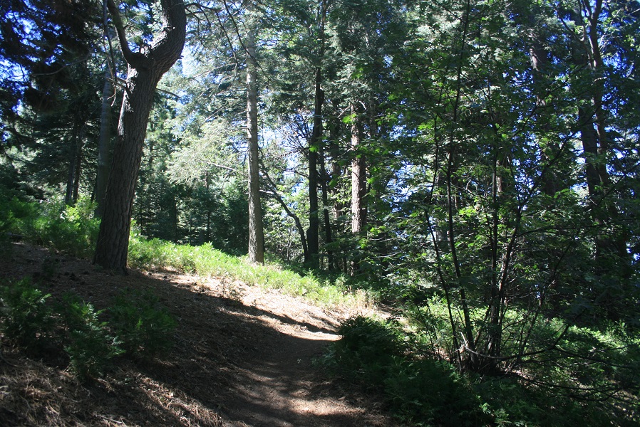
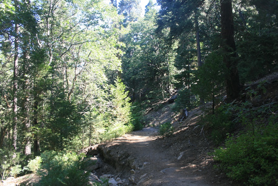
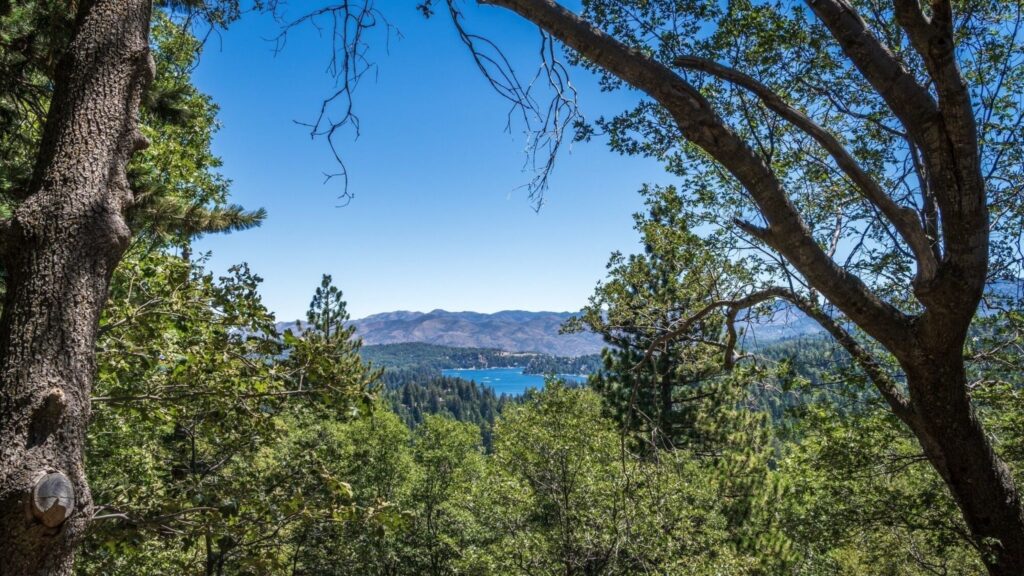
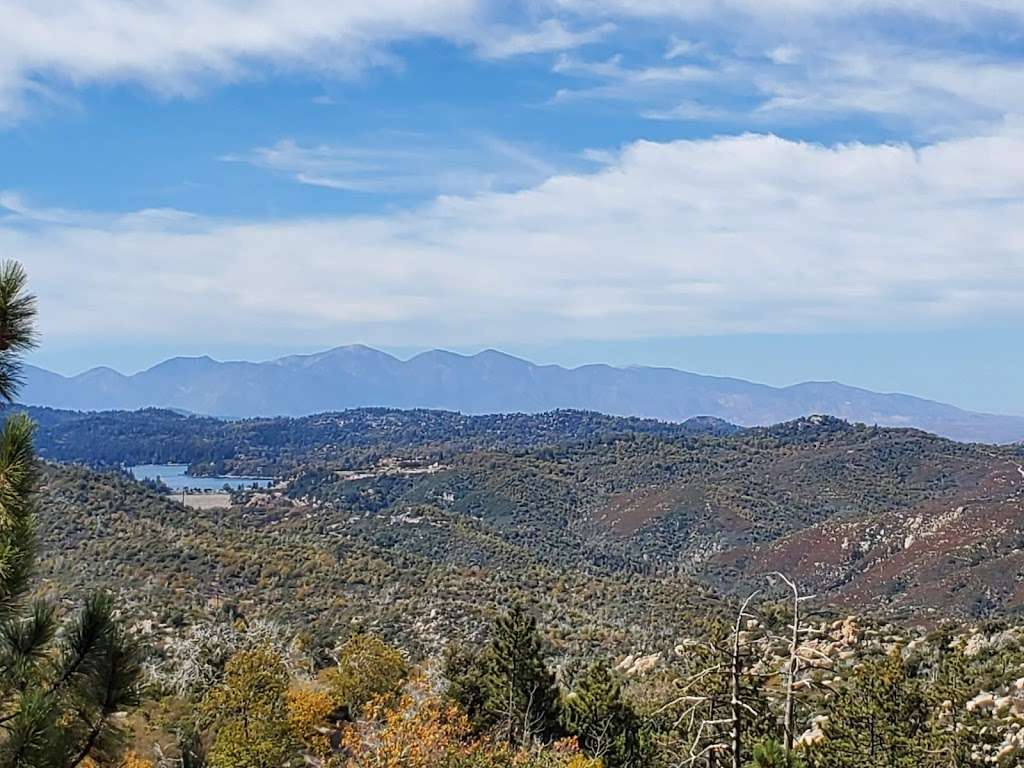
Whether you are looking for a long adventurous expedition, or an afternoon walk beside a sparkling lake, there is a variety of hiking experiences to suit your skill level and scenic desire. Enjoy fresh air, majestic trees, colorful wildflowers, an abundance of vegetation, the sounds of birds, wildlife activity, waterfalls, creeks, lakes, and breathtaking scenery with surprising panoramic mountain and valley views.
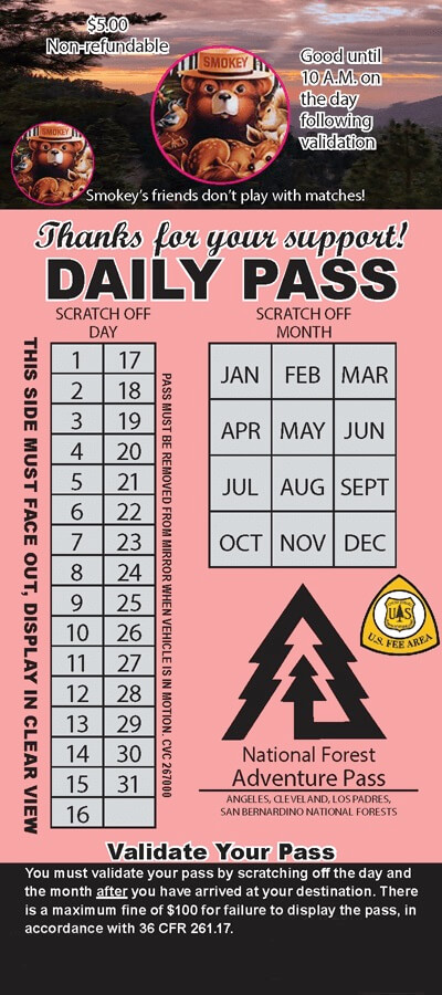
Know Before You Go – Recreation Passes & Permits
Certain recreation sites, trails and parking areas in the forest require recreation passes and permits. A National Forest Adventure Pass is required to park at many trailheads in the San Bernardino National Forest. It can be purchased at the Lake Arrowhead Visitor Center, 7-Eleven Store near Lake Arrowhead Village, Heaps Peak Arboretum Information Booth, and a few local retailers. Visit their website for current information fs.usda.gov
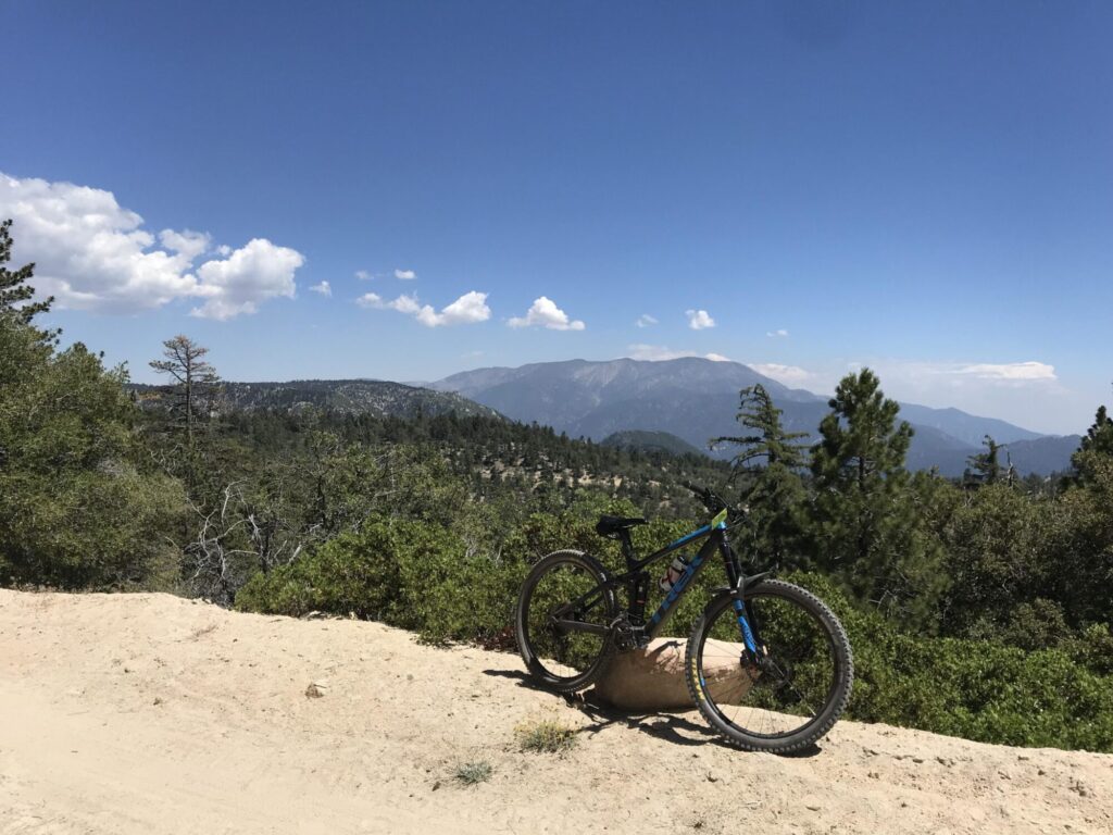
Hiking Trails
Little Green Valley Trail 2W10
- This trail provides you with outstanding views of Snow Valley and Slide Peak and is mainly used by mountain bikes. Also known for a shaded conifer forest.
- The trail begins near Snow Valley Mountain Resort (known for snow skiing in winter and mountain biking in summer) located at 35100 Hwy-18, Running Springs, CA 92382. Enter between the ski area’s west and east gates where the Keller Hut sign is located. Little Green Valley Trail climbs steeply to the north until you reach a meadow at Forest Service Road 2N19. The trail ties into 1W26, then to 2N64 which ties into 2N20 and back around behind the Nordic Ski Area (known for mountain biking and cross-country skiing) to make a loop.
Trail of the Phoenix - Children's Forest Trail 2W09
- Also known as the Children’s Forest Trail, this paved nature trail with a grade of 5% or less, begins at the entrance of the National Children’s Forest Visitor Center off Keller Peak Road. The trail is specifically designed and maintained to accommodate the needs of the visually and physically disabled and is wheelchair accessible. Keller Peak Fire Lookout Tower is a short drive up the road that offers excellent views of the San Bernardino Mountains including three lakes: Lake Arrowhead, Lake Gregory, and Silverwood Lake. On a clear afternoon day views of the Pacific Ocean and Santa Catalina Island are possible.
- Located at 32573 Highway 18, Running Springs, CA 92382
Exploration Trail 2W09X
- A family friendly trail with a 12% grade designed by children along with the U.S. Forest Service personnel with interpretive panels located throughout. During winter, the trail offers an exciting snowshoe or cross-country skiing trek.
- Located next to the National Children’s Forest Visitor Center adjacent to Deerlick Fire Station on Hwy-18 in Running Springs, CA 92382.
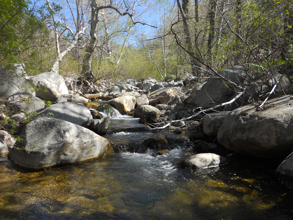
Fisherman’s Camp/Crab Creek Trail 2W07
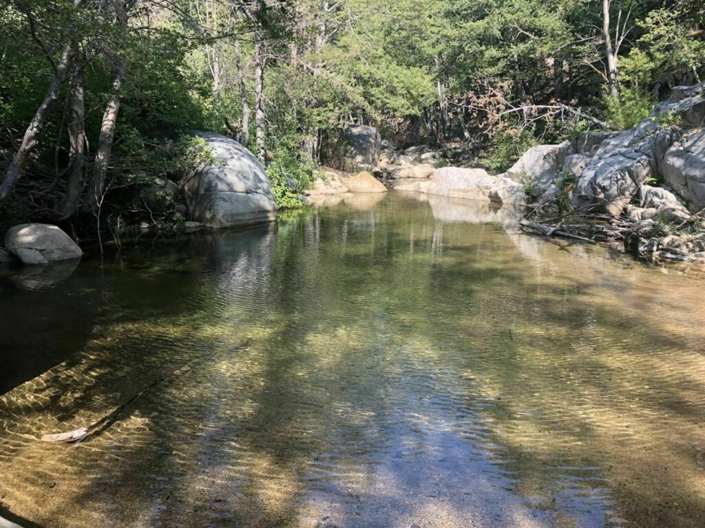
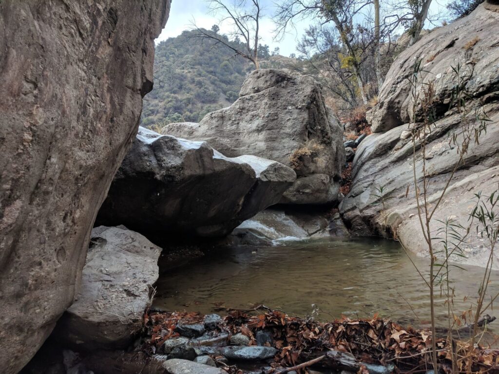
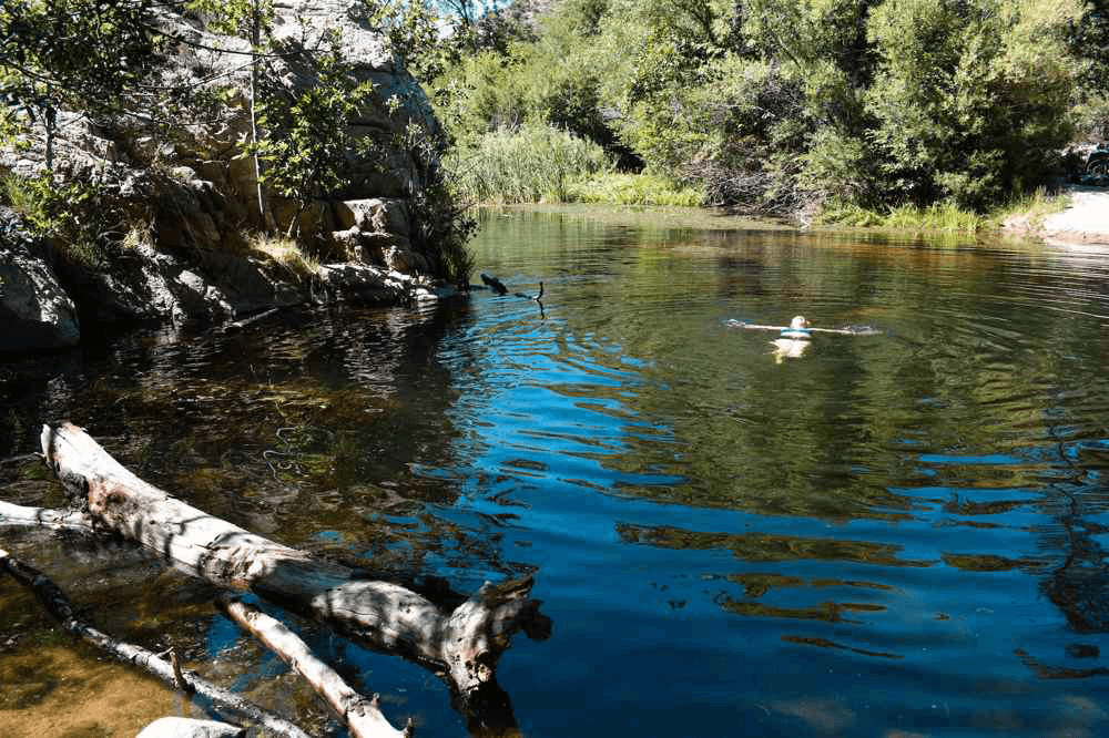
- The scenery along this trail is exceptional and features beautiful wildflowers and majestic trees. It’s close to Fisherman’s Group Campground (group permit and reservations required to camp). The trail descends moderately westward crossing Crab Creek, one of the best-hidden swimming holes in southern California and is 1.3 miles from Deep Creek. Attempting to cross Deep Creek when it is running high can be dangerous.
- Located near Running Springs, CA 92382 it begins on Forest Service Road 3N34. Users have reported that the road leading to this trailhead is only passable in a 4WD vehicle.
Hawes Peak Trail 2W08/2W14
- This trail is at a higher elevation where you will meander through a Pinyon and Juniper woodland. The area is known for its history of the early settlers, miners and cattlemen in the San Bernardino Mountains. It’s near other intersecting trails, and close to Tent Peg Campground.
- Located near Green Valley Lake, from Running Springs, CA 92382 travel east on Hwy-18 and turn left on Green Valley Lake Road. Turning left on Forest Road 3N16 towards Crab Flats Campground, the trail begins by following Crab Flats Trail 2W08 from FS Road 3N34 to the Pacific Crest Trail. Follow the PCT east 0.3 mile to 2W03 and go north 3 miles to the junction with 2W14.
North Shore Recreation Trail 3W12
- A great hike with a variety of landscapes, scenic views and is next to North Shore Family Campground, and McKay Park (picnic area, kids playground, dog park, and views of the lake) near Lake Arrowhead. It’s good for those who like a bit of a hiking challenge, and elevation changes. Dogs are also able to use this trail but must be kept on leash.
- Located in Lake Arrowhead, CA 92352 where the trail begins just behind the campground on Hospital Road off of Hwy-173. The trail descends along seasonal Little Bear Creek to FS Road 2N26Y, intersecting the road about 1 mile above the Splinter’s Cabin Trailhead, which is an excellent starting point to the world renown Pacific Crest Trail (PCT).
Heaps Peak Arboretum Trail 3W05
- This interpretive trail begins at Heaps Peak Arboretum, and is an easy walk for all ages. It takes you through a self-guided tour with 24 points of interest about native plants and wildlife. Along the way, hikers will find such trees as the Incense Cedar, Sugar Pine, Knobcone Pine, Coulter Pine, Black Oak, Quaking Aspen, White Fir and Dogwood (renowned for its spectacular springtime blooms). The site was constructed and is maintained by volunteers from the Rim of the World Interpretive Association.
- Heaps Peak Arboretum is located 2 miles east of the Skyforest Ranger Work Center, on Hwy-18 in Skyforest, CA 92385.
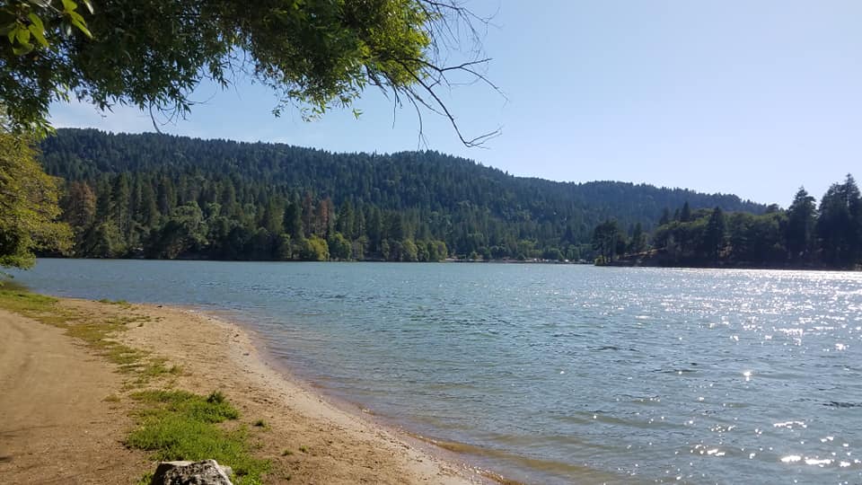
Nature Trail - Lake Gregory Regional Park
- This is a perfect walking trail around beautiful Lake Gregory surrounded by a cedar and pine forest. There are fitness stops and benches along the way. Lake Gregory Regional Park is a hidden gem tucked in the cool cedar and pine forest. This lakeside trail begins from the back of the South Beach parking area. Dogs are also able to use this trail but must be kept on leash, and there is a Dog Park.
- From Highway 18, take Lake Gregory Drive to San Moritz Drive. Turn Right on San Moritz and look for the Parking area on your left.
Enchanted Loop Trail 3W18
- Hikers will see many types of trees including Ponderosa Pine, white fir, incense cedar, and black oak. Keep an eye out for wildlife like squirrels, deer, and many types of birds that call this area home.
- This trail is located within Dogwood Family Campground (Tents, RV Hookups, showers, and restrooms) near Lake Arrowhead, CA 92325 off Hwy-18. The trail offers several activity options and is accessible year-round. It begins near the amphitheater parking area. The trail winds through dense cedars and eventually joins the Dogwood Trail 3W04.
Dogwood Trail 3W04
- This is a beautiful, peaceful trail in a wooded area with gradual elevation change that offers the chance to see wildlife and is good for all skill levels. Dogs are also able to use this trail but must be kept on leash.
- The trail is located next to Dogwood Family Campground (Tents, RV Hookups, showers, and restrooms) near Lake Arrowhead, CA 92325 off of Hwy-18. The trail offers several activity options and is accessible year-round.
Tunnel II Trail 3W19
- This trail presents beautiful views of Miller Canyon and Lake Silverwood. All fitness levels will enjoy a day hiking in nature that is easy to explore with vistas along the way.
- The Tunnel 2 Trail begins at Forest Service Road 2N34. Take Grass Valley Rd. to Clubhouse. Follow Clubhouse to Fairway, continue Fairway, turning right on Brentwood. Turn left on Sonoma Drive, Lake Arrowhead, CA 92352 to 2N24A. Go left on 2N34A and park at the intersection of 2N24A and 2N24, the trailhead is on right.
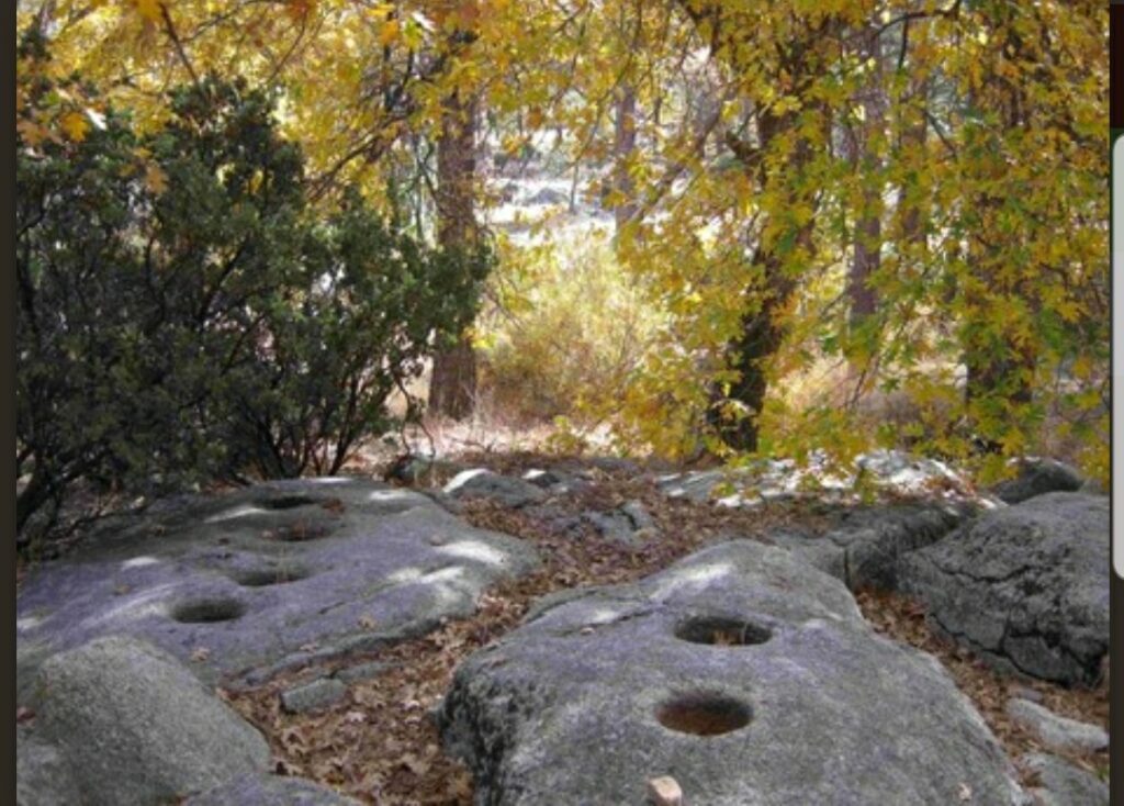
Metate Indian Rock Trail 3W15
- Pronounced “meh-TAH-tay” this historic trail leads to bedrock mortars used by the Serrano Indians to grind acorns and to make flour. The Serrano came to this area each spring because of the plentiful acorn crop and the mild weather. Bedrock mortars were formed by the grinding action of mono and pestle stones. This short but scenic trail takes you through a grassy woodland populated with Manzanita, Black Oak and Pines Trees.
- The trail is located off Hwy-173 near Peninsula Road in Lake Arrowhead, CA 92325. The trail begins immediately east of Rock Camp Station across the highway from the Metate Trailhead parking area. Please be respectful of these cultural artifacts when you are examining them along the trail.
Pinnacles Trail 3W16
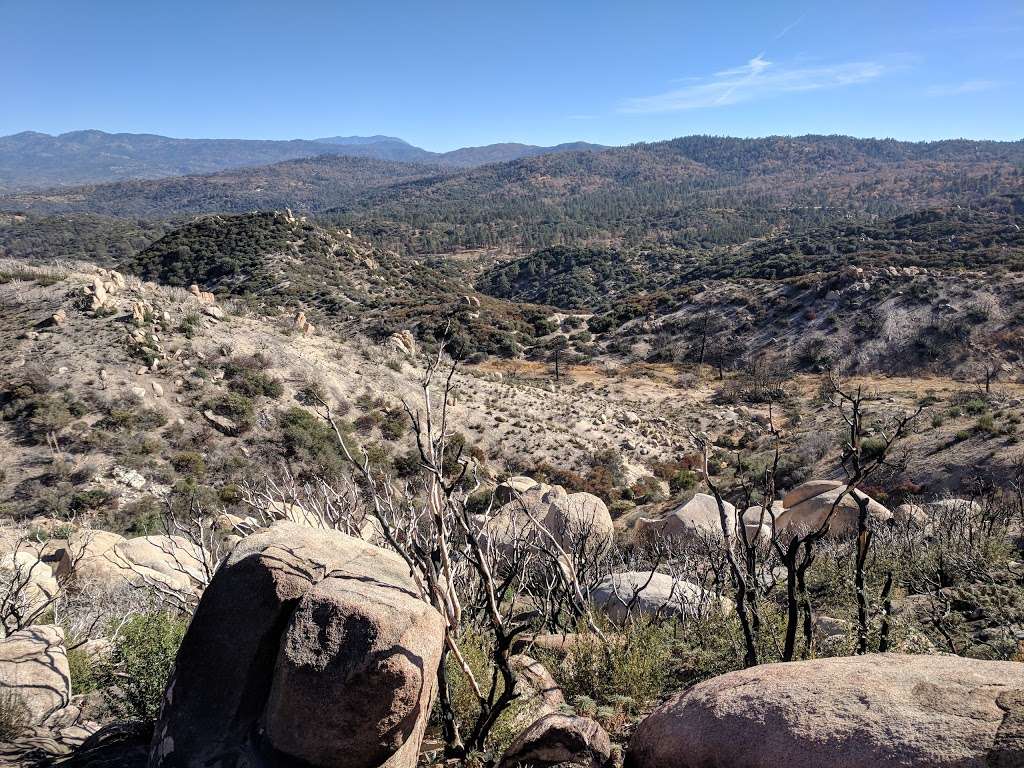
- The trail ascends through rocky terrain and ends at the top of the Pinnacles peak, providing spectacular views of the surrounding area. Along the trail there are steel posts and rock cairns to help you find the path as the trail travels over and around large boulders. The rock stacks will guide you to the peak. From the top, on clear days you can investigate Mojave Desert. At the summit there is a register book to sign. Dogs and horses are also able to use this trail.
- Pinnacles Trail Begins at the entrance to the Rifle Range on Hwy-173, in Lake Arrowhead, CA 92352, just 0.7 miles north of Rock Camp and ends at the top of the peak.
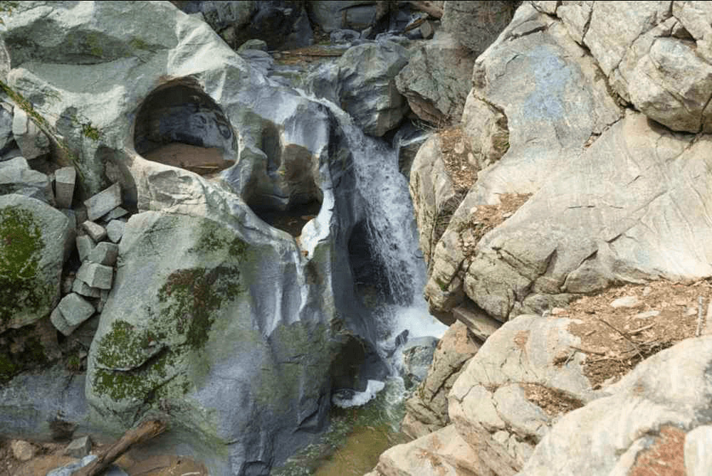
Seeley Creek Trail at Heart Rock 4W07
- This trail follows Seeley Creek to an overlook called “Heart Rock” which marks the trail’s end where there is a heart-shaped hole in the cliff next to a picturesque 20-foot waterfall. The gentle grade of this trail makes it an excellent walk for all ages. Dogs are also able to use this trail but must be kept on leash.
- Located near Cedarpines Park, CA 92322 the trail begins on Forest Service Road 2N03, ¼ mile south of the entrance to Camp Seeley on Hwy-138.
Ponderosa Trail
- The whole family will enjoy this easy and scenic hike within tall pine and cedar trees that has a spur trail to a spectacular vista point.
- This trail is located across from Pine Crest Center along Hwy-189 in Twin Peaks, CA 92391
Will Abell Memorial Trail
- The trail is good for all skill levels and it ascends and descends the ridge through one of Lake Arrowhead’s most impressive forests with a view of Lake Arrowhead. Dogs are also able to use this trail but must be kept on leash.
- This trail is located at Arrowhead Ridge on Grass Valley Road in Lake Arrowhead, CA 92352.
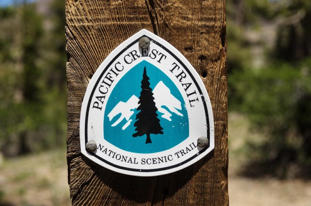
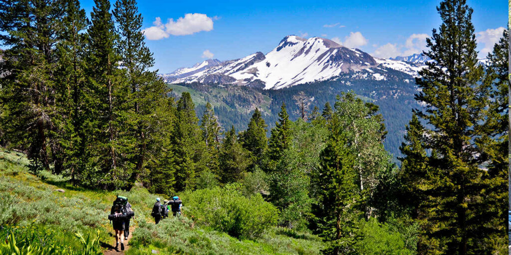
The Pacific Crest Trail (PCT)
Known as “America’s Greatest Wild & Scenic Trail Experience“, the PCT is 2,650 miles long stretching from Mexico to Canada through the states of California, Oregon, and Washington. It is an adventurous and challenging hike within America’s most scenic and varied terrain. Ranging from scorching deserts to snowy mountains, the trail is divided into 30 sections: 18 sections in California, 7 in Oregon, and 5 in Washington. The average length of each section is 91 miles. Routing through the Lake Arrowhead Mountain Communities in California, you can hop on the Pacific Crest Trail from a few locations. It is wise to “know before you go”, so be sure to visit the Pacific Crest Trail Association website pcta.org for current and important information.
Crab Flats Trail 2W08
- Hikers will enjoy a variety of forest settings. Take FS Road 3N16 to where this section of the PCT meanders along scenic Holcomb Creek and passes Crab Flats Campground and Holcomb Crossing Trail Campground.
Crab Flats Trail 2W08 to Splinter’s Cabin
- Along this portion of the PCT, you will have spectacular views toward the Lake Arrowhead area. Splinter’s Cabin is a starting point for a memorable hiking experience.
Devils Hole to Hot Springs
- This stretch of the PCT follows scenic Deep Creek winding its way along lush valleys tucked into the pristine wilderness past a variety of beautiful spots, including popular warm springs, and the famous Aztec Falls.
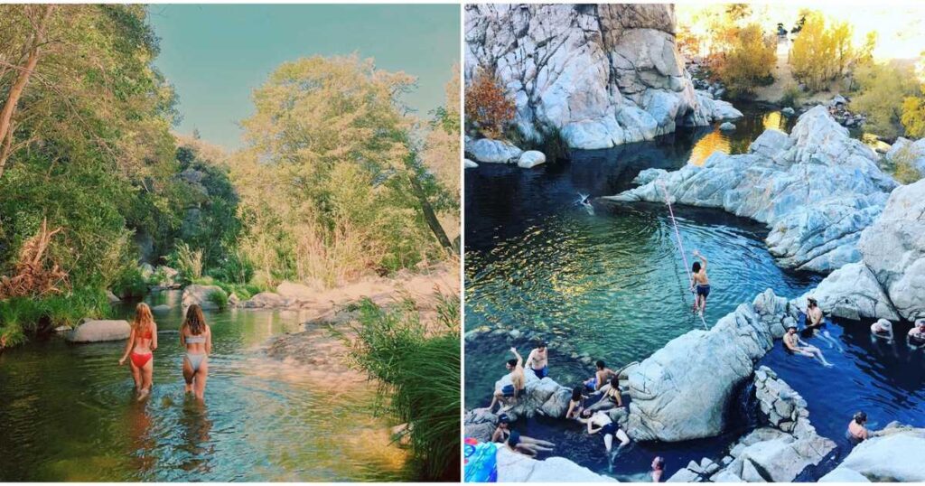
Hot Springs to Mojave Dam
- The final portion of the PCT within the Mountaintop Ranger District crosses Deep Creek on a high bridge and passes some favorite local swimming holes.